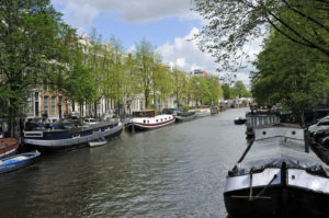
Along Amsterdam’s Singel Canal (Photo by Don Knebel)
In the middle of the thirteenth century, Dutch fisherman established a trading village along the Amstel River in northwest Holland. The village became known as “Amsterdam” after a dam protecting the area from flooding. To protect against invaders, residents built a semi-circular moat around their village, extending south from the IJ, at the time a bay. In 1585, Amsterdam expanded beyond the moat and residents began using the moat, named the “Singel Canal,” for transporting themselves and their goods. In 1613, with its population continuing to grow from international trade, the city began building three additional canals in concentric semi-circular rings around the original moat, quadrupling the area of the city. When completed, Amsterdam’s new canals were connected to each other and to the Singel Canal by radially-extending canals, enabling efficient water travel from any part of the city to another.
The seventeenth century was the Dutch Golden Age. Amsterdam, with a population of more than 200,000 in 1800, was among the world’s largest and most prosperous cities, attracting people from all over the world. One of its most popular destinations, especially for visiting sailors, was an area inside the Singel Canal known as “De Wallen,” featuring drinking, gambling and prostitution.
Today, Amsterdam’s 165 canals, with a combined length of about 65 miles, are spanned by more than 1200 bridges, three times as many as in Venice. Approximately 2500 houseboats are moored along the canal banks, most serving as permanent residences. Three million visitors a year board tour boats to traverse Amsterdam’s canal network, many ending their trip near De Wallen to explore Amsterdam’s still flourishing red-light district.